Real-Time Crisis Detection
Powered by Social Intelligence
AI-powered monitoring of Bluesky social media to detect emerging crises and deliver location-based alerts to first responders in real-time.
Comprehensive Crisis Intelligence
Bluesky social monitoring with Gemini AI delivers location-aware alerts and real-time insights for faster crisis response.
Gemini-powered AI analyzes Bluesky posts in real-time, categorizing sentiment as urgent, fearful, negative, neutral, or positive to identify emerging crises.
Receive alerts for crises within 100km of your location, or monitor specific regions globally with custom preferences.
Get instant alerts for new crises, severity changes, and updates via platform and email notifications based on your preferences.
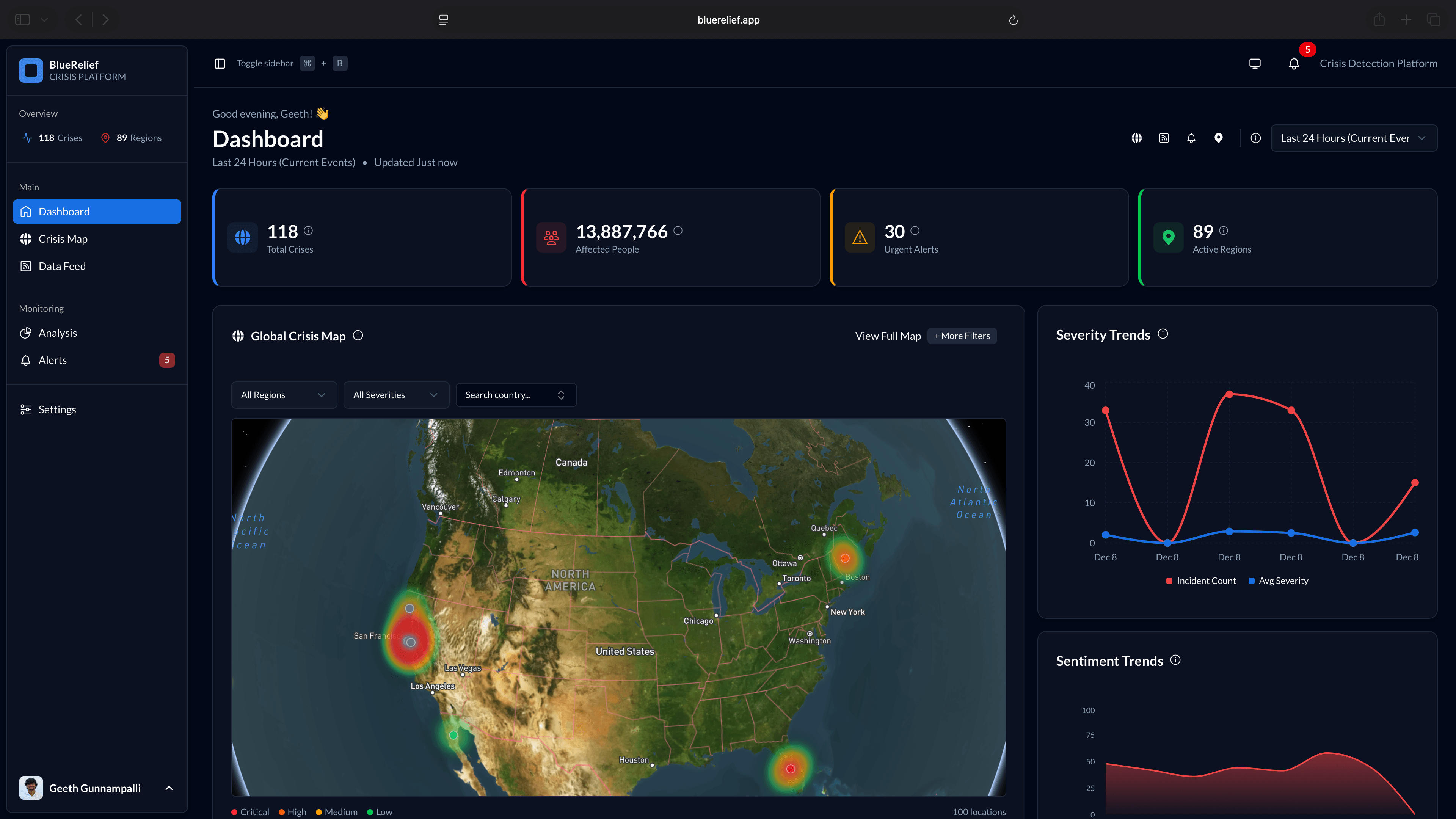
Track disasters by severity from Info to Critical with population impact estimates and time-series analysis for each event.
Visualize crisis locations on Mapbox-powered maps with regional breakdowns and affected area visualization.
Personalize your experience with custom regions, disaster types, severity thresholds, and notification preferences.
How BlueRelief Works
From social posts to actionable intelligence in seconds
Social Monitoring
BlueRelief continuously monitors Bluesky's social firehose in real-time, collecting posts from users worldwide.
AI Analysis
Gemini AI analyzes each post's sentiment (urgent, fearful, negative, neutral, positive) and extracts crisis information, location, and severity.
Crisis Detection
Posts indicating disasters are categorized by type (earthquake, flood, fire, etc.) with severity levels from Info to Critical.
Smart Alerts
Users receive location-based alerts within 100km radius or for custom monitored regions, filtered by their preferences.
Population Estimates
For each crisis, the system estimates affected population using geographic data and crisis radius.
Analytics & Maps
Dashboard visualizes trends, patterns, regional breakdowns, and crisis locations on interactive maps.
All of this happens automatically, 24/7, ensuring you never miss a critical event in your area or regions of interest.
Save Lives with Faster Crisis Response
Traditional crisis detection relies on delayed official reports. BlueRelief monitors social media in real-time, detecting crises as they unfold through on-the-ground posts, enabling faster response when minutes matter.
Real-Time Detection
Monitor Bluesky's social firehose to identify crises as they emerge, with automated sentiment analysis detecting urgent posts instantly.
Pattern Recognition
Track recurring patterns, disaster types, and regional trends with AI-powered analytics and time-series visualization.
Geo-Aware Alerts
Get location-based notifications within 100km radius or monitor custom regions worldwide with population impact estimates.
Ready to Transform Crisis Response?
Start receiving location-based crisis alerts from Bluesky social media today. Monitor your area or regions worldwide.